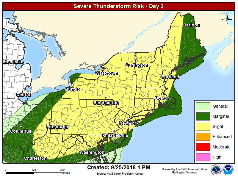
A strong cold front will cross N NY & VT Wed aftn thru Wed eve. A line of thunderstorms is expected to develop out ahead of the front. If storms can become organized, there is the threat of localized wind gusts 50 to 60 mph for a brief period of time as the system moves through. pic.twitter.com/LOmg4VzUro
Source: Twitter NWS Burlington

