=== THUNDERSTORM POTENTIAL FRIDAY === The potential exists for T-storms across the Adirondacks and central/southern VT Friday afternoon into Friday evening. A few storms may become severe. We will keep you advised.pic.twitter.com/xztSnP5Pcl

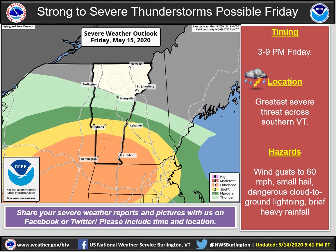
=== THUNDERSTORM POTENTIAL FRIDAY ===

The potential exists for T-storms across the Adirondacks and central/southern VT Friday afternoon into Friday evening. A few storms may become severe. We will keep you advised.

Source: Twitter NWS Burlington

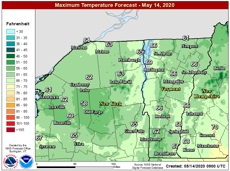
A beautiful day is on tap for the region as high pressure and sunny skies give way slowly to increasing clouds by later in the afternoon. High temperatures should climb, finally to near seasonal mid-May norms in the 60’s under light south to southwest winds. Enjoy!pic.twitter.com/wiTEt226Bt

A beautiful day is on tap for the region as high pressure and sunny skies give way slowly to increasing clouds by later in the afternoon. High temperatures should climb, finally to near seasonal mid-May norms in the 60’s under light south to southwest winds. Enjoy!

Source: Twitter NWS Burlington

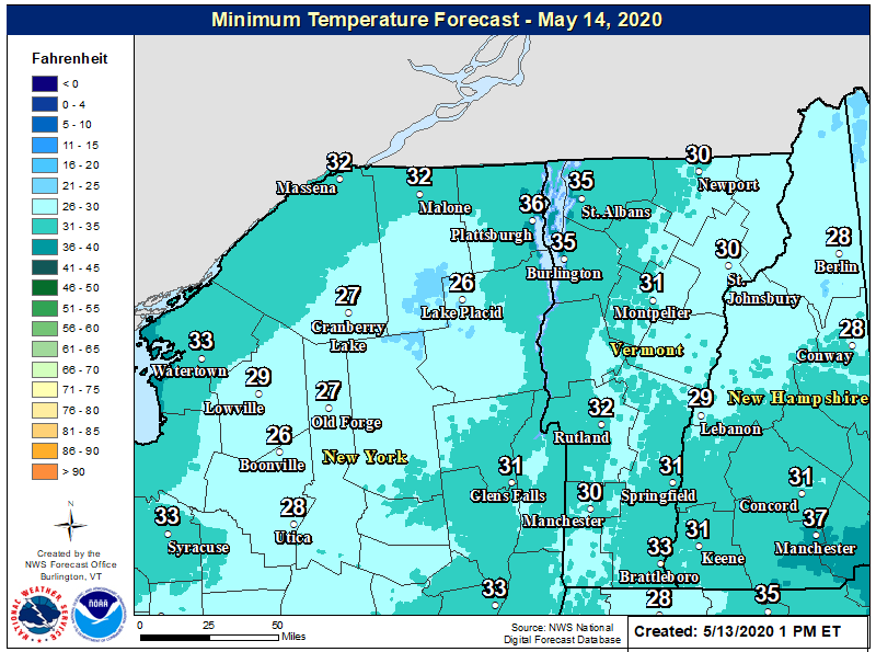
Another chilly night is on tap tonight. A Freeze Warning is in effect for portions of northern New York, north, central and southern VT. Closer to Lake Champlain, a Frost Advisory is in effect. Check your local forecast at: http://weather.gov/btv pic.twitter.com/MmTt8PYxlo

Another chilly night is on tap tonight. A Freeze Warning is in effect for portions of northern New York, north, central and southern VT. Closer to Lake Champlain, a Frost Advisory is in effect. Check your local forecast at: http://weather.gov/btv 

Source: Twitter NWS Burlington

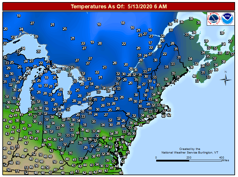
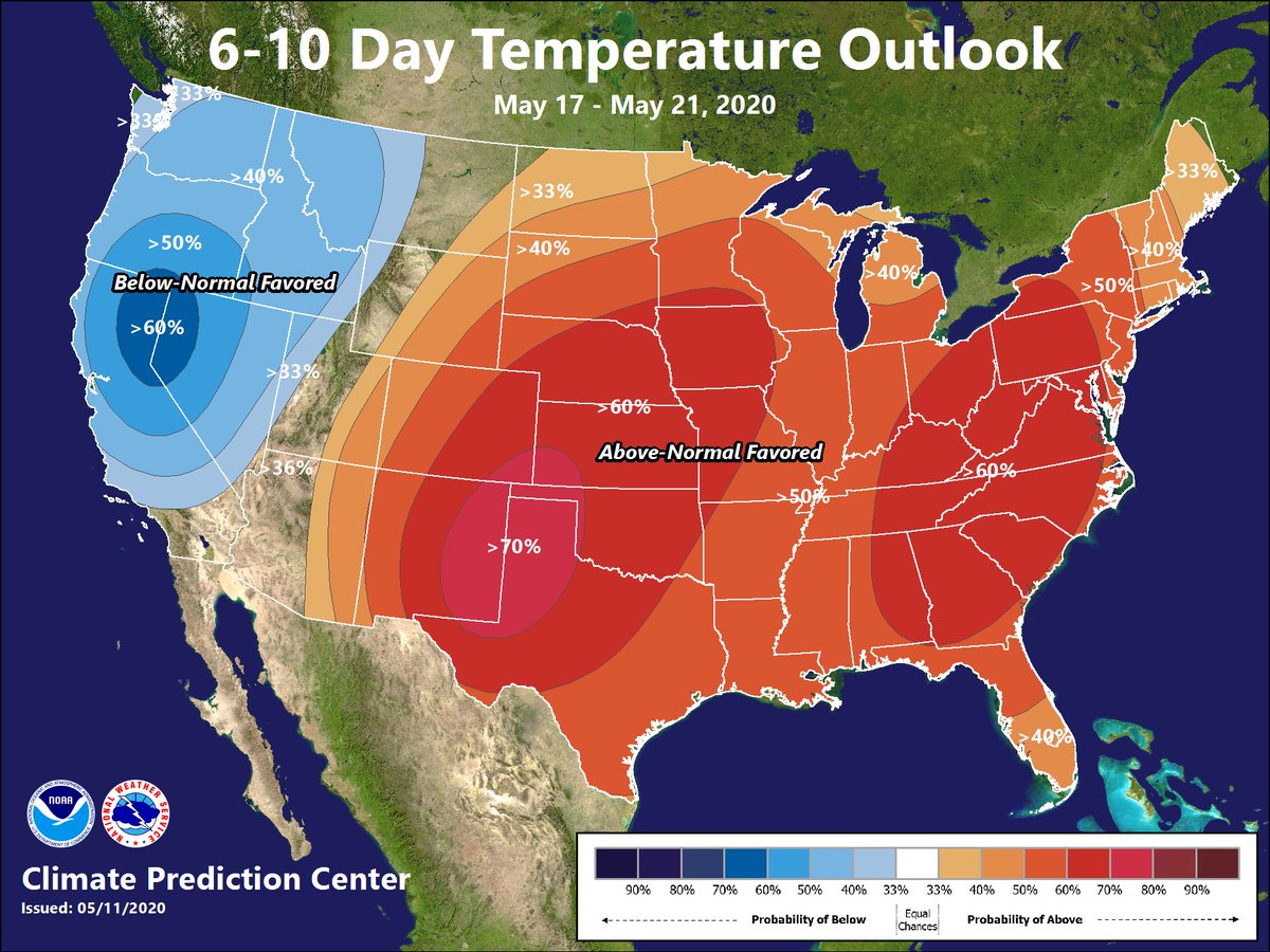
Did someone put a request in for warmer weather? After a cold night tonight we start trending to normal temperatures by Friday and above normal temperatures this weekend into next week. The warm air looks here to stay once it arrives. Hello spring!pic.twitter.com/nd5QMCPxH4

Did someone put a request in for warmer weather? After a cold night tonight we start trending to normal temperatures by Friday and above normal temperatures this weekend into next week. The warm air looks here to stay once it arrives. Hello spring!

Source: Twitter NWS Burlington

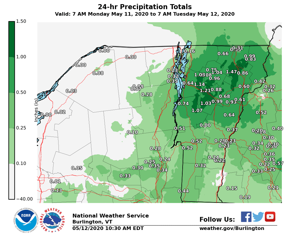
Here’s a look at the snowfall and precipitation totals from yesterday’s storm. We are confident this was the last snowfall event of the 2019-2020 snow season as the weather pattern begins to change. Full list of reports can be found here: https://bit.ly/2AelG7h pic.twitter.com/ULVd5WOYHg

Here’s a look at the snowfall and precipitation totals from yesterday’s storm. We are confident this was the last snowfall event of the 2019-2020 snow season as the weather pattern begins to change. Full list of reports can be found here: https://bit.ly/2AelG7h 

Source: Twitter NWS Burlington