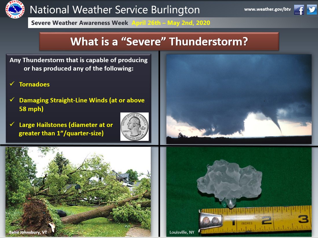
The U.S. National Weather Service defines a severe thunderstorm as any one of the following: a thunderstorm that produces a tornado, winds of at least 58 mph (50 knots), and/or hail at least 1″ (2.5 cm) in diameter. #SevereWxAwarenessWeekpic.twitter.com/ALhRLspTyZ

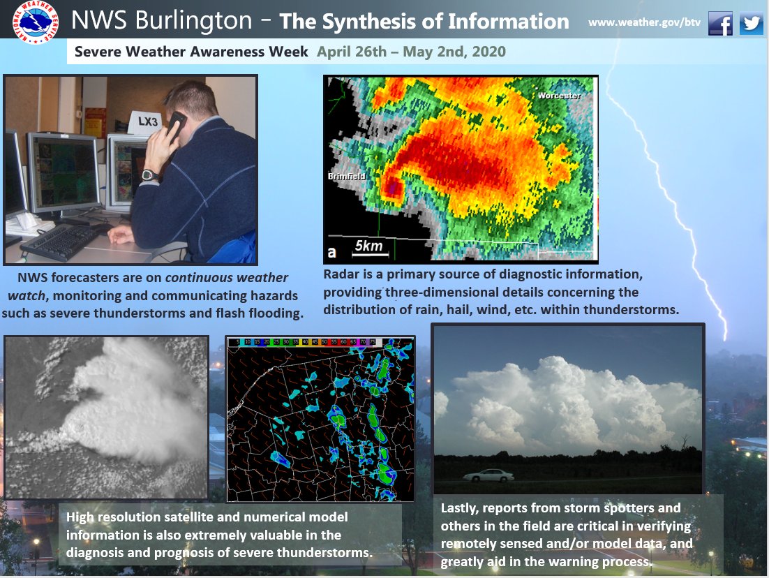
The U.S. National Weather Service defines a severe thunderstorm as any one of the following: a thunderstorm that produces a tornado, winds of at least 58 mph (50 knots), and/or hail at least 1″ (2.5 cm) in diameter. 

Source: Twitter NWS Burlington

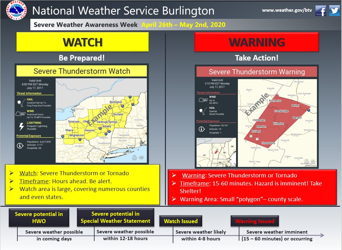
When conditions warrant, convective “Watches” are issued on the time scale of several hours in advance of severe weather. “Warnings” mean severe weather is imminent! This graphic provides some examples. #SevereWxAwarenessWeekpic.twitter.com/jU8N6D6HGq

When conditions warrant, convective “Watches” are issued on the time scale of several hours in advance of severe weather. “Warnings” mean severe weather is imminent! This graphic provides some examples.

Source: Twitter NWS Burlington

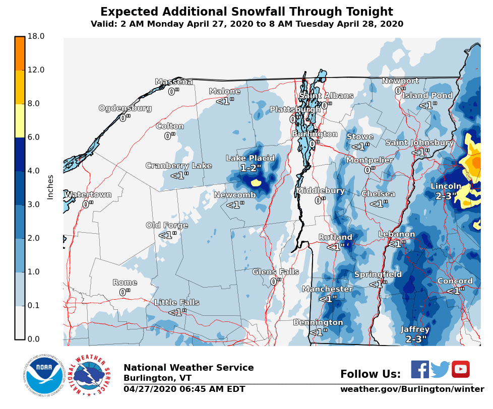
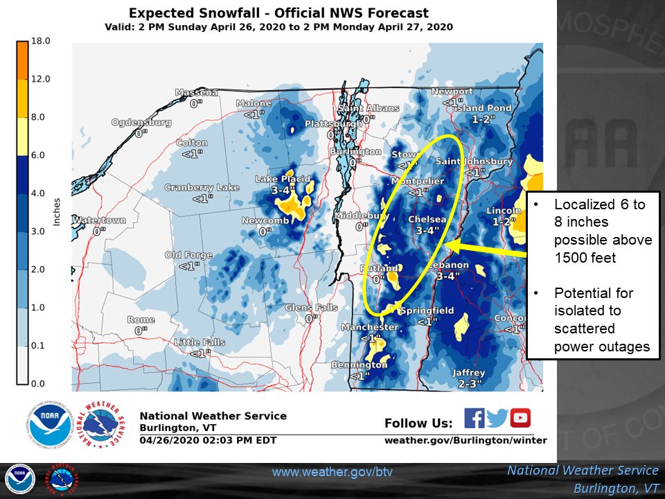
Rain and snow showers will continue this morning, then gradually taper off through the afternoon and evening. Additional snow accumulation will mainly be confined to elevations above 1000 ft. Did you see any snow overnight? If so, please let us know how much. Thanks!pic.twitter.com/j74JawZkHD

Rain and snow showers will continue this morning, then gradually taper off through the afternoon and evening. Additional snow accumulation will mainly be confined to elevations above 1000 ft. Did you see any snow overnight? If so, please let us know how much. Thanks!

Source: Twitter NWS Burlington

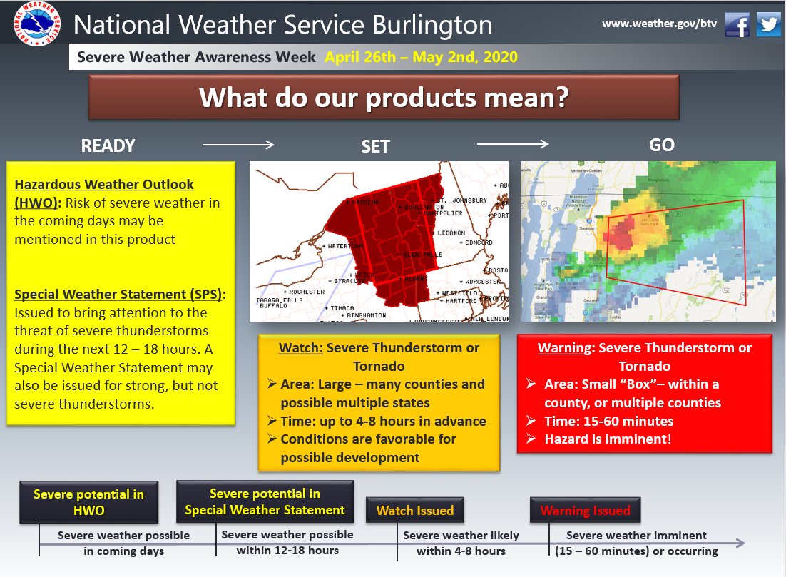
When the potential exists for severe weather, the National Weather Service employs a “ready-set-go” philosophy to convey the threat. This example graphic shows how “ready-set-go” works. #SevereWxAwarenessWeekpic.twitter.com/DnsvbDi2EG

When the potential exists for severe weather, the National Weather Service employs a “ready-set-go” philosophy to convey the threat. This example graphic shows how “ready-set-go” works.

Source: Twitter NWS Burlington

Snow is already falling across the higher terrain of the southern Green Mtns as of this hour. Accumulating snow is possible for locations above 1000 ft, mainly along and east of the Greens overnight. Check your local forecast at: http://weather.gov/btv pic.twitter.com/66fva00yAk

Snow is already falling across the higher terrain of the southern Green Mtns as of this hour. Accumulating snow is possible for locations above 1000 ft, mainly along and east of the Greens overnight. Check your local forecast at: http://weather.gov/btv 

Source: Twitter NWS Burlington