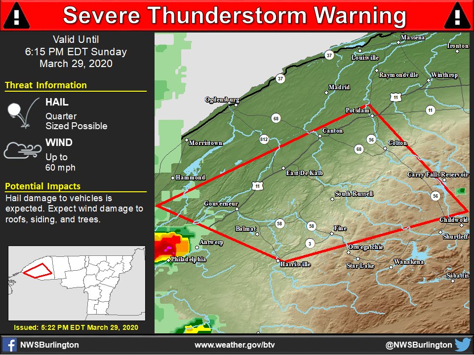
A severe thunderstorm warning is now in effect for southern St. Lawrence County in northern New York as shown in this image. As of 5:21 PM, a severe thunderstorm near West Fowler is moving northeastward at 55 MPH. This storm is capable of 60 MPH wind gusts and quarter size hail.pic.twitter.com/wb77ma09Op

A severe thunderstorm warning is now in effect for southern St. Lawrence County in northern New York as shown in this image. As of 5:21 PM, a severe thunderstorm near West Fowler is moving northeastward at 55 MPH. This storm is capable of 60 MPH wind gusts and quarter size hail.

Source: Twitter NWS Burlington
On this day in 1956, the 50th anniversary of the establishment of the Weather Bureau Office in Burlington, VT was celebrated by hosting an open house. Now known as the National Weather Service, we are currently in our 70th yr within the BTV Airport. http://bit.ly/3bpZCE7 pic.twitter.com/PhHSxytl3Q

On this day in 1956, the 50th anniversary of the establishment of the Weather Bureau Office in Burlington, VT was celebrated by hosting an open house. Now known as the National Weather Service, we are currently in our 70th yr within the BTV Airport. http://bit.ly/3bpZCE7 

Source: Twitter NWS Burlington

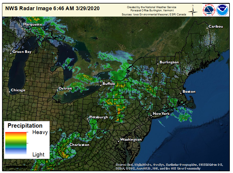
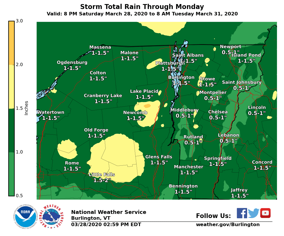
Rainfall will overspread the region from the west this morning with most locations receiving an inch of rain through the day on Monday. Area rivers and streams are expected to remain within bankfull but we will be keeping an eye on them nonetheless.pic.twitter.com/2vy6ALEpUk

Rainfall will overspread the region from the west this morning with most locations receiving an inch of rain through the day on Monday. Area rivers and streams are expected to remain within bankfull but we will be keeping an eye on them nonetheless.

Source: Twitter NWS Burlington

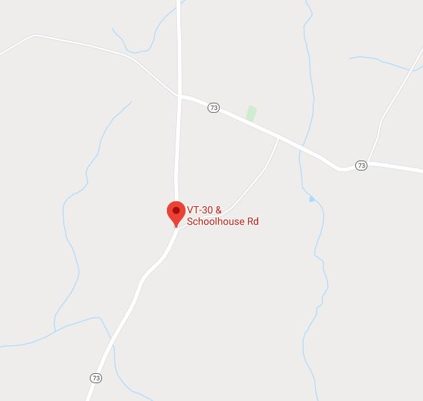
If you must travel please note: VT-30 in Sudbury, near Schoolhouse Rd, is CLOSED at this time due to a crash and downed power lines. The closure will last until further notice. Seek alternate route.pic.twitter.com/rxoCk21TqO

If you must travel please note: VT-30 in Sudbury, near Schoolhouse Rd, is CLOSED at this time due to a crash and downed power lines. The closure will last until further notice. Seek alternate route.

Source: Twitter vt511

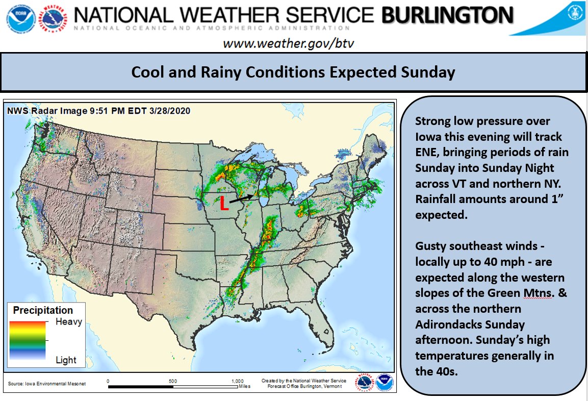
Unsettled weather arrives early Sunday morning, with gusty winds along the western slopes of the Green Mountains and northern slopes of the Adirondacks; peak gusts near 40 mph in the afternoon.pic.twitter.com/6s6vsY0QWX

Unsettled weather arrives early Sunday morning, with gusty winds along the western slopes of the Green Mountains and northern slopes of the Adirondacks; peak gusts near 40 mph in the afternoon.

Source: Twitter NWS Burlington

Fair weather ends tonight as a slow-moving low pressure system brings rain to the region through Mon. VT’s Northeast Kingdom could see wintry mix at the onset late tonight. Rain may change to snow Sun & Mon nights, especially over the high terrain. Minor snow/ice accum possible.pic.twitter.com/sK26Ovmxff

Fair weather ends tonight as a slow-moving low pressure system brings rain to the region through Mon. VT’s Northeast Kingdom could see wintry mix at the onset late tonight. Rain may change to snow Sun & Mon nights, especially over the high terrain. Minor snow/ice accum possible.

Source: Twitter NWS Burlington

Another beautiful spring day is on tap for the North Country before rain moves in Sunday morning. Rainfall totals of 0.75 – 1.25 inches are expected with freezing rain/sleet possible across northeastern Vermont Sunday morning. Check out https://tinyurl.com/wg7fdya  for more info.pic.twitter.com/cjSzIogtUp

Another beautiful spring day is on tap for the North Country before rain moves in Sunday morning. Rainfall totals of 0.75 – 1.25 inches are expected with freezing rain/sleet possible across northeastern Vermont Sunday morning. Check out https://tinyurl.com/wg7fdya  for more info.

Source: Twitter NWS Burlington

Special Weather Statement issued March 28 at 6:05AM EDT by NWS

…Active Period Of Weather Sunday Into Monday… A slow moving storm system will bring widespread precipitation to all of northern New York and Vermont Sunday into Monday. The majority of the precipitation will be in the form of rain with most locations picking up anywhere from three quarters to an inch and a quarter of rain. These amounts combined with some high

Source: National Weather Service Alerts for Vermont