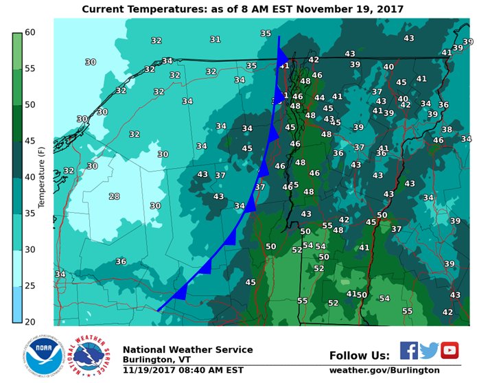
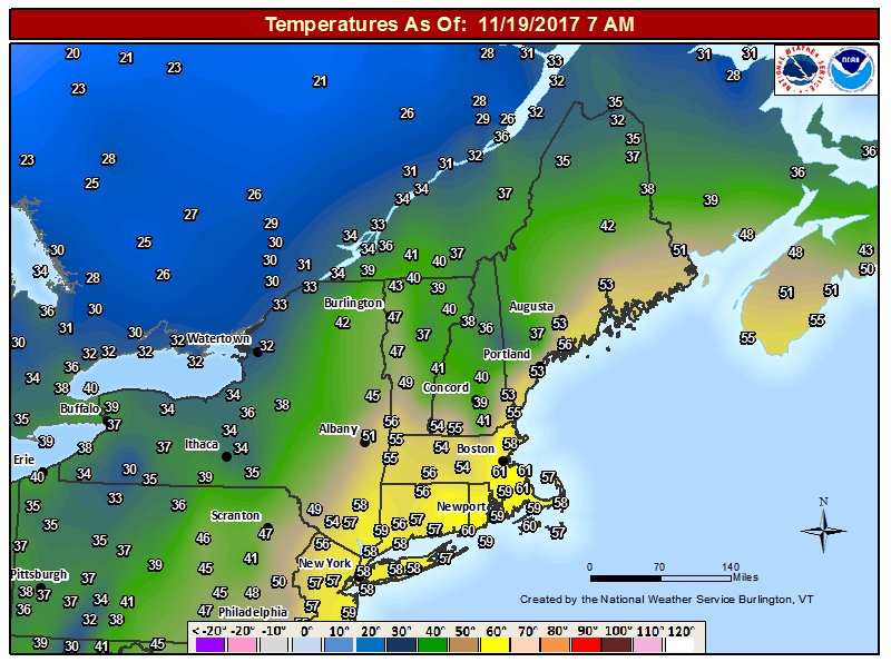
Here’s a look at temperatures at 8 am with the analyzed cold front, notice the 40s/50s in the Champlain Valley and southern VT due to southerly winds. Shortly after 9 am, the winds shifted to west-northwest at BTV, thus the frontal passage with colder air to follow. #vtwx #nywxpic.twitter.com/4OQC8f3Fg4

Here’s a look at temperatures at 8 am with the analyzed cold front, notice the 40s/50s in the Champlain Valley and southern VT due to southerly winds. Shortly after 9 am, the winds shifted to west-northwest at BTV, thus the frontal passage with colder air to follow.

Source: Twitter NWS Burlington

Wind Advisory issued November 19 at 6:28AM EST until November 19 at 6:00PM EST by NWS

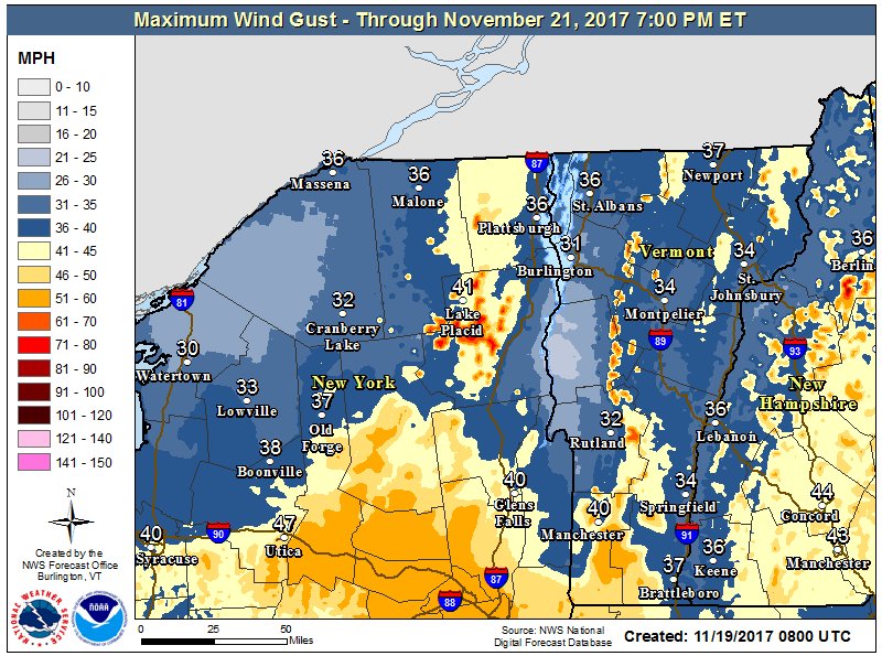
…WIND ADVISORY IN EFFECT UNTIL 6 PM EST THIS EVENING… The National Weather Service in Albany has issued a Wind Advisory, which is in effect until 6 PM EST this evening. * Locations…Bennington and western Windham Counties in Southern Vermont. * Winds…Southerly winds 15 to 25 mph with gusts up to 50 mph,

Source: National Weather Service Alerts for Vermont

Special Weather Statement issued November 19 at 6:02AM EST by NWS

…Winds increasing sharply behind a cold front this morning… A cold front will quickly move west to east across the forecast area this morning. The front will be accompanied by a quick increase in westerly winds gusting to 40-55 mph. The front will cross the Mohawk Valley and Southern Adirondacks 6-7 am, the Catskills and Hudson Valley 7-8 am, and the Taconics and Western

Source: National Weather Service Alerts for Vermont

Special Weather Statement issued November 18 at 9:27PM EST by NWS

…Pockets of Freezing Rain Across Central and Eastern Vermont… Developing precipitation across central and eastern Vermont this evening will initially fall as a mix of sleet and freezing rain in some of the deeper valley locations along and east of the Green Mountains. Temperatures very near freezing at 9 PM will gradually warm with south winds overnight, resulting in a transition to

Source: National Weather Service Alerts for Vermont

Special Weather Statement issued November 18 at 7:54PM EST by NWS

…Lingering pockets of freezing rain across portions of the western Mohawk Valley, southern Adirondacks and Lake George region, and southern Vermont through 10 PM this evening… Temperatures continue to hover near the freezing mark within some sheltered areas of the western Mohawk Valley, southern Adirondacks and Lake George region, valley areas of eastern Windham County in

Source: National Weather Service Alerts for Vermont