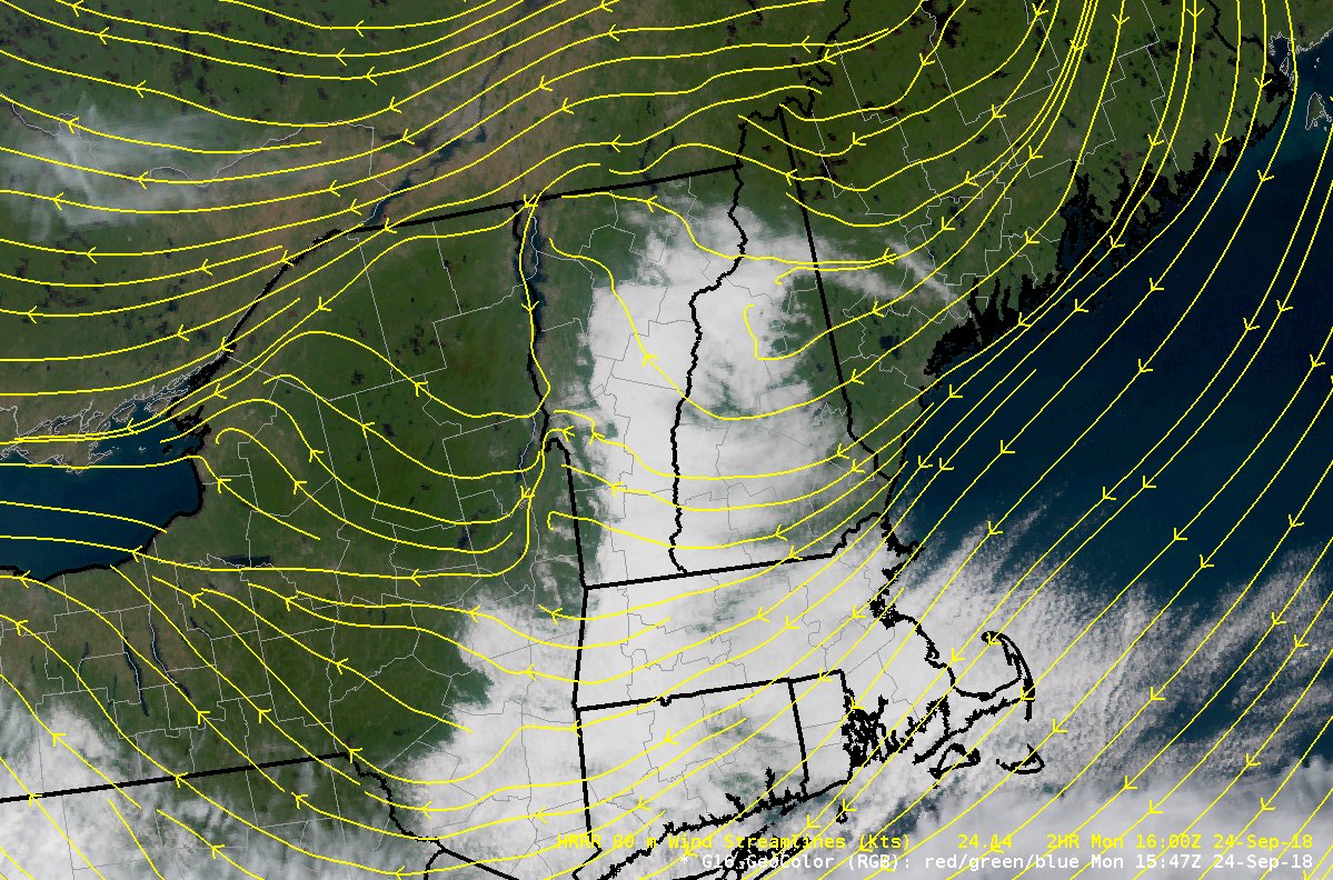
For #MeteorologicalMonday low-level stratus clouds (in white) east of the Green Mountains are seen on GOES-16 Geocolor satellite image. Streamlines from the 80-m wind forecast from the HRRR model shows air off the Gulf of ME moving onshore cooling and condensing forming clouds. pic.twitter.com/zFa0EiG6Z8
Source: Twitter NWS Burlington

