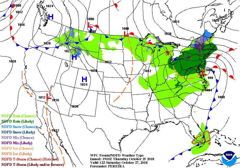
The Saturday morning weather map shows low pressure along the East Coast with a wintry mix changing to a cold rain likely as temperatures slowly warm into the mid 30s to mid 40s. Some minor snow and ice accumulation is possible in the mountains. Stay tuned for additional updates. pic.twitter.com/JCOJ3FSSvt
Source: Twitter NWS Burlington

