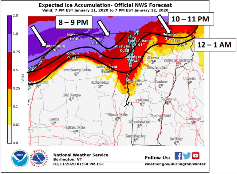
We are tracking the southward progression of sub-freezing air, currently >100 miles away in Canada, to northern NY and VT. This ice accumulation map shows when and where we expect this to happen, allowing rain to change to freezing rain, especially in valley locations. pic.twitter.com/H3uCXdVZ73
Source: Twitter NWS Burlington

